VANCOUVER — The threat of flooding has prompted evacuation alerts in two communities in B.C.'s southern Interior, while several high streamflow advisories in the region have been upgraded to flood watches.
The Regional District of Similkameen-Okanagan says residents in the villages of Coalmont and Tulameen, northwest of Princeton, should be prepared to leave in case an evacuation order follows due to warming weather and rapid snowmelt.
It says in a release that residents would be given as much advance notice as possible, but changing conditions might not make that possible.
The district says people should pack essentials such as medication, valuable documents and government-issued identification and arrange to stay with family, friends or other accommodation.
Environment Canada had warned that a series of severe thunderstorms with heavy downpours across the region could add to the flood risk but later lifted the advisories.
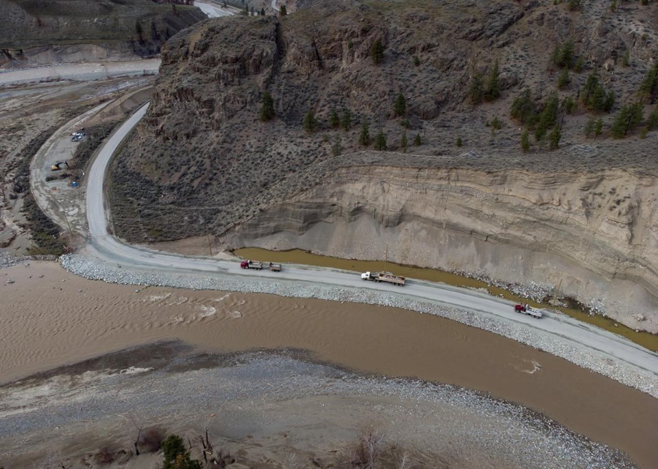
The River Forecast Centre has issued upgraded flood watches for Spius Creek near Canford and the lower Nicola River near Spences Bridge, and the province says a stretch of Highway 1 between Lytton and Spences Bridge has been closed as a precaution.
The Transportation Ministry says the roadway will be re-evaluated Saturday morning, and crews would be on hand for any necessary cleanup and repairs.
The same stretch of highway was severely damaged in flooding last fall.
High streamflow advisories were upgraded to flood watches for the east Okanagan, including Mission Creek and tributaries east of Vernon, Kelowna, Penticton and surrounding areas, as well as the West Kettle River in the Boundary region.
Cold, rainy weather delayed the spring thaw by about a month and there's concern that several days of above-average temperatures could cause heavy snowpacks to melt rapidly, overwhelming some waterways.
The forecast centre says current modelling suggests there's a possibility for some flooding this weekend, with parts of the Okanagan and Boundary regions among the hardest hit, depending on rainfall amounts.
The centre is advising people to stay clear of fast-flowing rivers and potentially unstable riverbanks during high streamflow periods.
In northwestern B.C., a flood watch remains in place for the Bulkley River near Smithers and evacuation alerts are in effect for some low-lying properties.
Evacuation alerts have also been posted in the Regional District of Kitimat-Stikine for properties along the Skeena River north of Terrace.
High streamflow advisories remain in place for much of northern B.C. and extend from the Cariboo south to the United States border.
The Cariboo Regional District says it has activated its emergency operations centre in preparation for the forecasted weather, and it's encouraging people living near water to take precautions and watch for warning signs of flooding.
This report by The Canadian Press was first published June 3, 2022.
The Canadian Press


