MEXICO CITY (AP) — Hurricane Erick was nearing Mexico's Pacific coast on Wednesday on a forecast track to bring heavy rain, strong winds, storm surge and possible mudslides to its southern coastal region, forecasters said.
Up to 20 inches (51 centimeters) of rain could fall across the Mexican states of Oaxaca and Guerrero, with lighter amounts in Chiapas, Michoacan, Colima and Jalisco states, the Miami-based U.S. National Hurricane Center said in an advisory. The rainfall threatened flooding and mudslides, especially in areas with steep terrain.
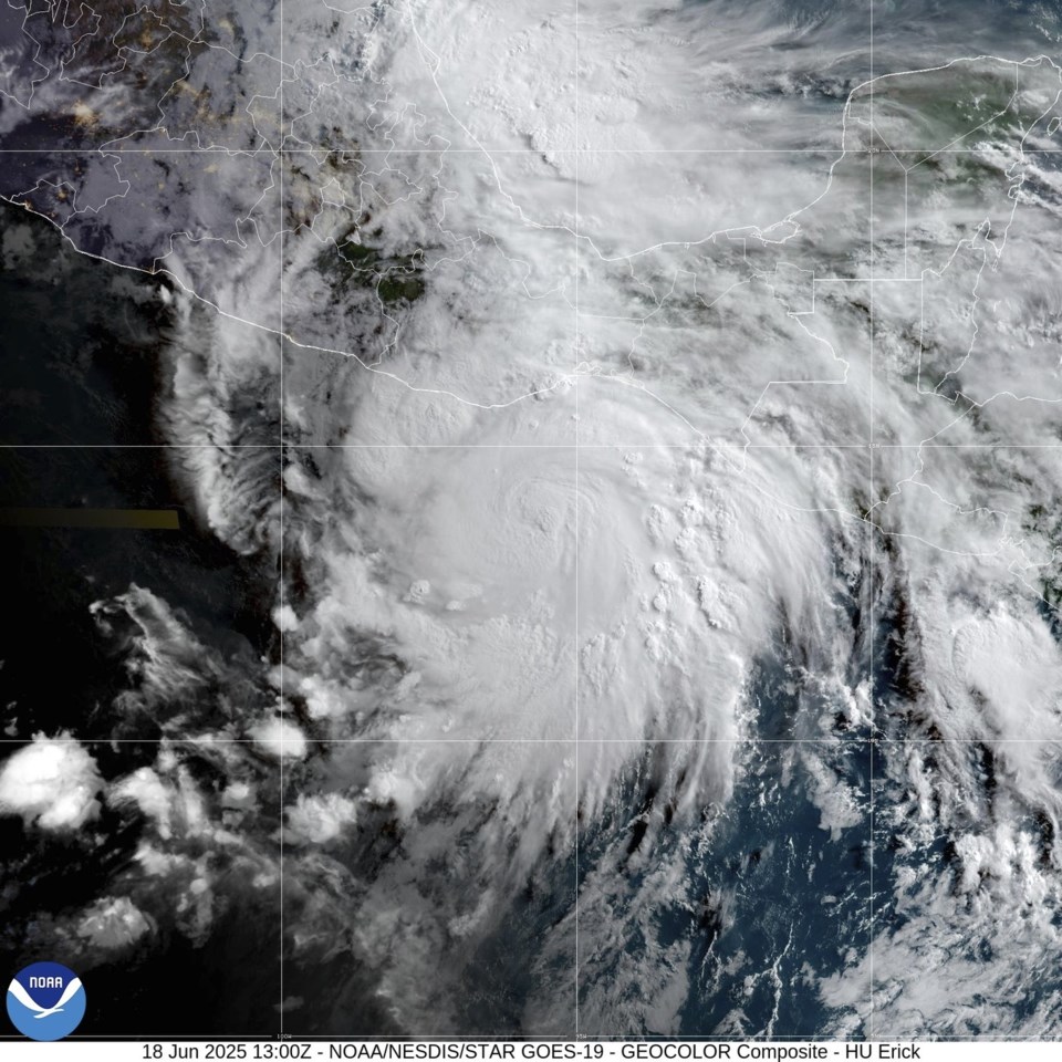
The Category 1 storm on Wednesday morning was located about 130 miles (205 kilometers) south-southeast of Puerto Ángel, Mexico, and had maximum sustained winds of 85 mph (140 kph). It was moving northwest at 8 mph (13 kph).
The hurricane center said Erick is rapidly intensifying and is expected to be at or near major hurricane status as it approaches the Mexican coast on Thursday, where it could make landfall. A major hurricane is defined as Category 3 or higher and wind speeds of at least 111 mph (180 kph).
Erick is forecast to be a major hurricane by Wednesday night or Thursday morning.
The storm’s projected path would take its center near the resort of Acapulco, which was devastated in October 2023 by Hurricane Otis, a Category 5 hurricane that rapidly intensified and caught many unprepared.
At least 52 people died in Otis and 32 were missing, after the storm severely damaged almost all of the resort’s hotels.
Guerrero state Gov. Evelyn Salgado said Tuesday that lessons were learned from that storm. She said all schools in the state would close Wednesday and said 582 shelters were prepared to receive people who might evacuate their homes.
A hurricane warning was in effect for Acapulco to Puerto Ángel. A hurricane warning means hurricane conditions are expected in the area, and preparations to protect life and property should be rushed to completion, according to the hurricane center advisory.
The Associated Press


