I recently stayed in England with an old and dear friend who informed me, with much delight, that his great-grandfather had named Bowen Island! And so we hastened to the National Archives in Kew to peruse old journals and maps pertaining to the journeys of Captain George Henry Richards.
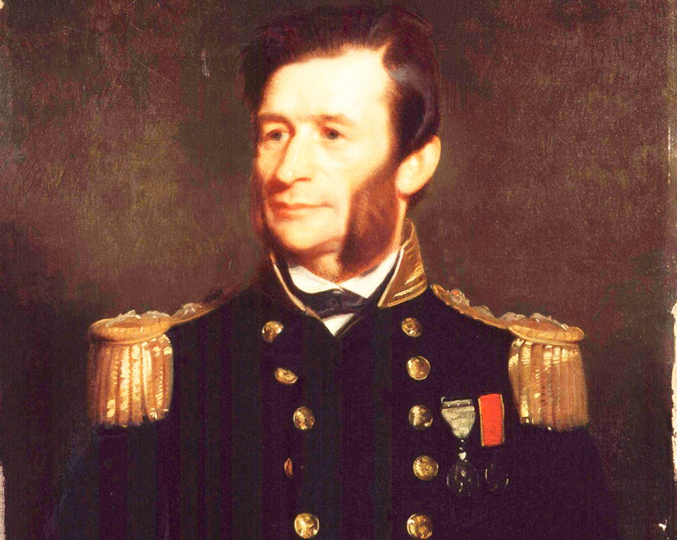
It is a most fascinating story. He was born in Cornwall, England, in 1832 and by the age of 12 had joined the Royal Navy. In the next 20 years he saw action in the first Opium War with China, surveyed the Falkland Islands and the coasts New Zealand. From 1852-54 he sailed in search of Sir John Franklin where he surveyed the coast travelling 2,000 miles by sledge in the Canadian Arctic. On his return to England he was promoted to Captain.
Now in command of a 21-gun screw survey vessel, H.M.S.Plumper, Capt. Richards sailed for the Pacific Northwest in 1856, ostensibly to help with the Anglo-American Boundary Commission but also to provide a British military presence in Victoria. He spent six months surveying in detail the waters between Vancouver Island and the US mainland as a basis for resolving the boundary negotiations.
By June 1858, gold fever hit the Fraser River and thousands of prospectors began arriving in Victoria. While helping to maintain law and order, and transporting men and goods, Captain Richards also had the urgent task of charting the lower reaches of the Fraser. And so, for the next two years he sailed through all the waters between Vancouver Island and the mainland. Six smaller boats set forth from Plumper each day, making detailed maps of every island in Howe Sound. Each evening, Richards would compile these drawings into an accurate map, sending them regularly to the Admiralty in London, urging them to print as soon as possible, since ships were entering the straits “really knowing nothing of navigation, and run considerable risks”.
I think, from his journals, I can pinpoint the date to October 26, 1860, when he records he “weighed anchor and proceeded up the Sound, sounding every one-quarter of an hour. Shark (his main survey boar) left for three days in charge of ___? ...foggy and drizzly… 9:10 – weighed and steamed up between Great (?) and Anvil Islands, turned off near ___ Island and proceeded down between Great Island and the Main, passed between Great Island and an island off it, sounding every mile, at Bowen Island.”
The next day he passed out of Howe Sound. When he sailed back to England in 1862, his senior surveyor, Daniel Pender, Lt. Richard Charles Mayne and Second Master Edward Bedwell carried on the work.
Considering that he named just about every place along the coast, it seems ironic that there is no mention at all of Captain Richards in our local maps. Admittedly, his inspiration often came from the questionably glorious sea battle of the Glorious First of June, 1794 wherein the French and British fleets succeeded either in demolishing or in thwarting each other effectively enough so that both could claim victory. Under direct orders from Lord Earl Howe, Commander of the Fleet in his flagship, Queen Charlotte, (Howe Sound so named by Captain Vancouver earlier), was Rear Admiral James Bowen.
Other ships’ officers whose names might sound familiar were Admiral Sir George Montagu, Vice-Admiral Sir Alexander Hood, Rear-Admirals Alan Gardner and George Bowyer, Captains William Truscott, John Payne, Thomas Pasley, John Hutt, James Gambier, Sir Roger Curtis, Cuthbert Collingwood and John Elphinstone. Admiral Sir Richard Keats did not take part in this battle as his ship was being repaired. There are many more inlets, islands, channels and coves around us which Captain Richards named.
He returned to England to an illustrious career until retirement as hydrographer of the Royal Navy. For another 20 years he was chairman of Telcon, a telegraph construction company responsible for laying 76,000 miles of submarine cables. Admiral Richards, K.C.B. died in 1896. He was described in the Proceeedings of the Royal Society obituary as “a man of great ability, of sound commonsense, and of untiring activity”.
Among one of his treasures, my friend has a small painting of Lady Jane Franklin, presented by her to Captain Richards in thanks for his efforts in trying to locate her husband. It would be very fitting if we could find and name a place on Bowen as tribute to his untiring activity in opening up our west coast waters.


