When Noah Carson received the assignment of drawing a map for his cartography class at UBC, the subject of his map was not even in question.
“I live on Bowen so it was a natural choice,” says Carson, a fourth year student in the Sustainability Studies Program at UBC.
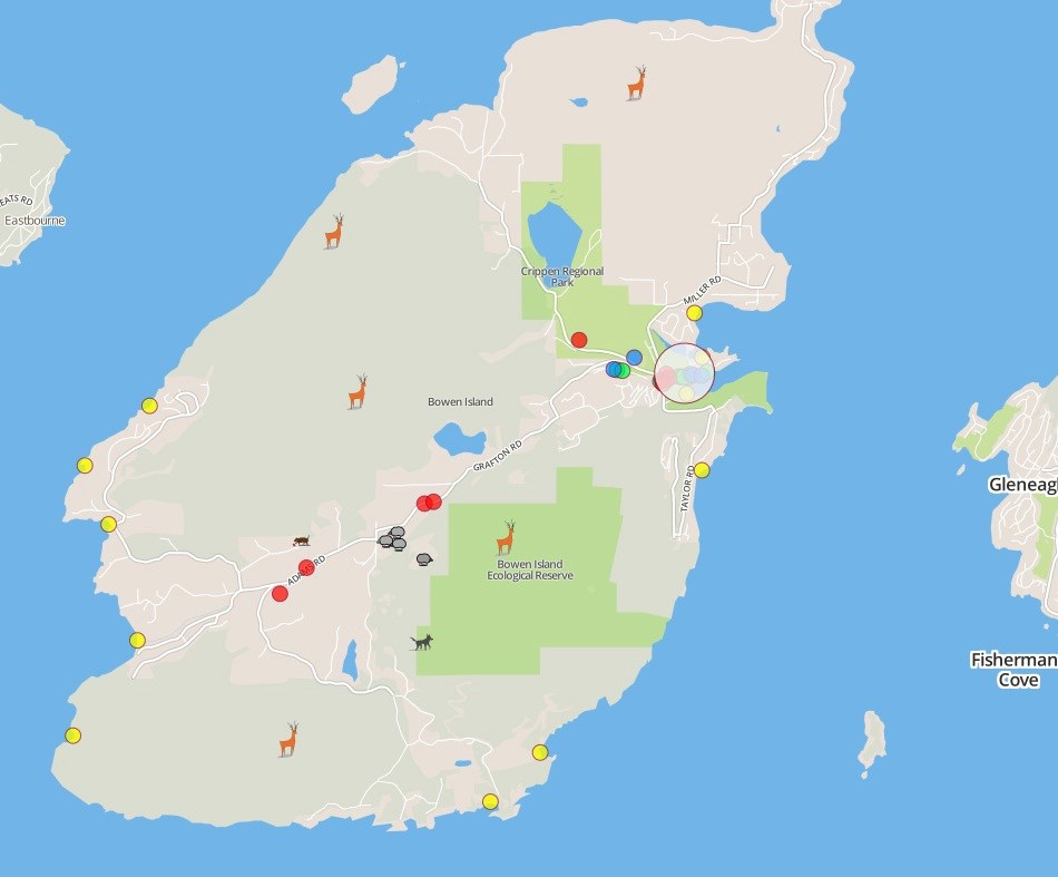
To bring his map to life, Carson decided not just to draw a map on paper but to create an online map where viewers can zoom in on specific points for information.
“It’s kind of like Google Maps,” says Carson. “But on Google Maps there are only two beaches on Bowen, and one of them is mislabeled. I want people to know that Bowen Island is more than just empty space between a couple of beaches.”
Carson says he started working on the project in the Bowen library, and while he sat there, at least four tourists came in asking for directions to beaches and restaurants.
“The map is definitely geared towards tourists, but I also want things on there for locals, bits of local knowledge and nostalgia, things that would be of interest to local kids,” he says, making note of the sheep mid-Island, that his younger sisters have grown up visiting every year during lambing season.
Carson created the map on a program called Tile Mill and took pictures one rainy day just before the assignment was due.
“Now that its built, it is easy to upload new photos and change things,” he says. “So if a restaurant had a new special every month or every week, that could be something that could be continuously updated. Also, I would really like to get better photos.”
So far, Carson says he’s received great feedback from the community. To see his interactive map online go to: a.tiles.mapbox.com


