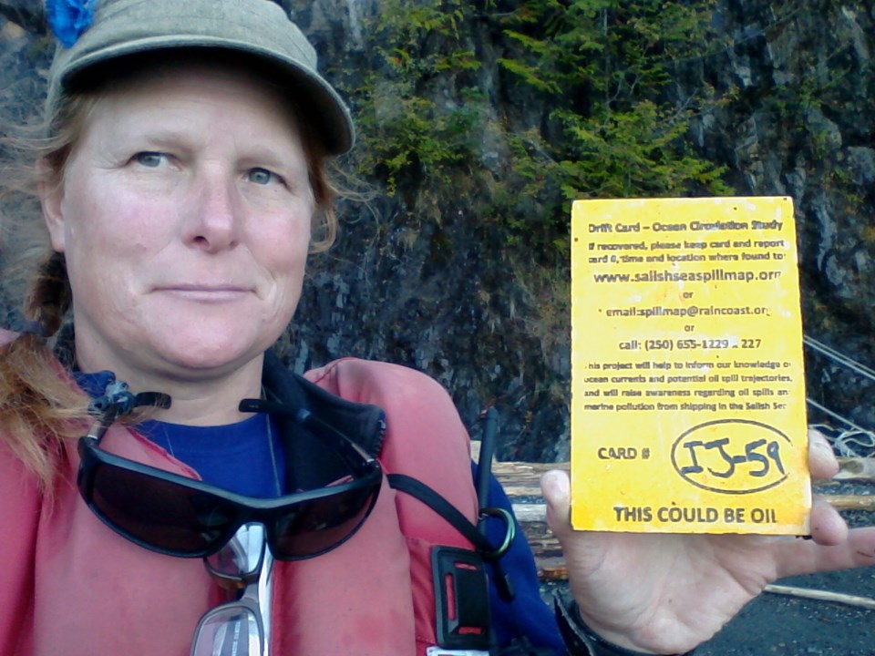
Last week, biologist Ramona de Graaf surveyed Bowen’s shoreline to determine where the tiny fish that act as the cornerstone for our ocean food-web might spawn. On Friday, September 27, she pulled up to a beach just north of Dorman Point that she calls beautiful, and full of potential. There, de Graaf found a yellow card that said, “THIS COULD BE OIL,” in bold letters.
Almost a month earlier (August 31) Ken and Nancy Huntingford were walking on the shore between Dorman Point and September Morn beach, just below their house and found a similar card, this time, coloured blue.
“Ken said, look, there’s oil,” says Nancy Huntingford. “And because we’d seen it on the news the night before, when I looked I knew exactly what it was.”
The cards, dropped in the ocean at various points and various times by members of the Raincoast Conservation Foundation, in conjunction with the Georgia Strait Alliance and the Friends of the San Juans, are meant to both raise awareness about the potential impact an oil spill could have on our coast, and to provide data about the potential movement of surface oil in our waters.
Four thousand of these cards have been dropped over the past year. The drop points were selected along the shipping route in areas where the potential for an incident is higher, whether through groundings or collisions. Most recently, cards were launched in the Fraser River just downstream of the Port Mann bridge. This is where the proposed pipeline (and the current one) cross and run along the banks. So far, roughly 1,500 of the cards have been recovered with the most distant ones travelling to Haida Gwaii and BC’s north and central coast. The card recovered by Ken and Nancy Huntingford was dropped near the Port Mann Bridge on August 26. The card recovered by Ramona de Graaf was dropped under the Second Narrows Bridge, also on August 26.
“People have accused this project of being solely a publicity stunt,” says Andy Rosenberger, a biologist with Raincoast. “This has been a very effective tool for public engagement. It makes an impact when people find a warning like this on their local beach. But a stunt implies that there’s no scientific merit in this exercise. We believe that the data we gather through this project will be useful to oceanographers and in spill response planning, and we’re collaborating with scientists to create better models about oil spills in these waters. We are also working on a number of papers we hope will be published in peer-reviewed journals.”
Rosenberger says that Kinder-Morgan’s application includes modeling on where oil would go if a spill were to occur from a few locations, and the results of the drift card project are comparable within the 15 day time frame that they examined.
“I think this is a good thing, because it means that we may have some idea what the impact might look like if a spill were to occur,” says Rosenberger, explaining that according to both results, an oil spill in the Fraser River would likely result in oil soaked coasts in the Southern Gulf Islands, the San Juan Islands and BC’s lower mainland. “And to me, the impact would be quite scary.”
To see where where ocean currents have carried the drift cards, check out the Salish Sea Spill Map.


