A commission charged with re-drawing B.C.’s federal election map is doubling down on its plan to carve out the main business district of West Vancouver and plunk it in the North Vancouver riding.
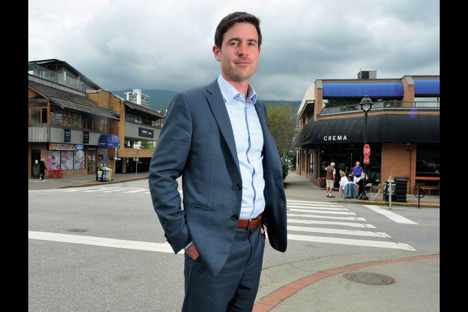
Patrick Weiler, the Liberal MP currently representing the West Vancouver riding, describes that as “cutting the heart out of West Vancouver to add it as an appendage to another riding.”
When the proposed boundary changes were first unveiled last year, Weiler voiced public opposition to the plan that would rob the riding’s largest community of its economic and historical centre.
John Weston, the former Conservative MP for the riding, also opposed the change, writing to the boundaries commission and urging them to “keep West Vancouver intact.”
Speakers at a June public hearing were also opposed to the change, the commission acknowledged in its report released last week, noting “it unreasonably split a key, historic municipal neighbourhood.”
But those objections weren’t enough to change the commission’s recommendation.
In fact, its latest recommendation is for even more of West Vancouver’s business district to be moved to the North Vancouver riding.
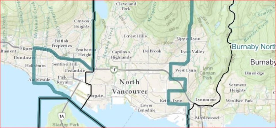
Under the proposed change released Feb. 8, the easternmost part of West Vancouver – including Park Royal, Sentinel Hill and all Ambleside (everything east of 21th Street) – would be cut from the West Vancouver electoral district and added to the North Vancouver riding. (The previous plan had recommended adding half of Ambleside, from 15th Street east, to the neighbouring riding.)
In making its recommendation to change the boundaries, the commission wrote it was aware of public concerns but concluded the existing riding of West Vancouver-Sunshine Coast-Sky to Sky represents too great a population, and that dividing West Vancouver was “the only fair and appropriate resolution to the electoral district’s high population.”
Weiler said he’s both “very disappointed” and surprised by that decision.
“I really disagree with the proposal that’s been put forward,” he said.
Weiler said prior to last summer’s public hearing, he went door-to-door in the area impacted by the change to find out what constituents thought of the plan. Most weren’t aware the change was being considered, he said, and those who were aware were opposed to it.
“There’s obviously very distinct communities in West Vancouver and North Vancouver,” he said.
Weiler said he’d hoped the commission would recognize the need to keep West Vancouver’s “community of interest” within one federal riding. But that’s not what happened.
The redrawn electoral map, which would push boundaries of all three North Shore ridings north and west, is part of a larger jigsaw puzzle being considered by the electoral boundaries commission as it adds one riding to the province of B.C. The additional riding is needed because of population growth in the province and to ensure that roughly the same number of people – 116,300 – are represented by each federal member of Parliament. But the creation of a new riding in the southern Interior, between Vernon and Kelowna, would also have a domino effect of boundary alterations in other areas of the province, including several ridings in the Lower Mainland.
The geographically diverse West Vancouver-Sunshine Coast-Sea to Sky Country riding currently has a population of about 131,000, while the target population for one riding is 116,300. Weiler noted, however, that ridings can be up to 25 per cent larger or smaller than the target population.
Under the latest proposed changes unveiled Feb. 8, all West Vancouver between Burrard Inlet and Highway 1 east of 21st Street would be added to the North Vancouver riding, which would be known as Capilano - North Vancouver. The name of the West Van riding would also change to Howe Sound - West Vancouver.
Chunks of Lynn Valley currently in the North Vancouver riding – including much of the area to the south of Lynn Valley Road and upper Lynn Valley to the east of Mountain Highway, as well as Capilano University – would also be added to the Burnaby-North Seymour riding. That riding is itself a product of an earlier redrawing of the election map that created a riding spanning Burrard Inlet.
Politically, removing Ambleside from the West Vancouver riding wouldn’t necessarily benefit either Liberals or Conservatives, as the area tends to split its votes between those parties.
Three of the polls that would be moved from West Vancouver to North Vancouver under proposed changes are on Squamish Nation lands.
Weston suggested in his letter last summer that if the boundaries commission needs to make a change to the riding, it would make more sense to cut out the Sunshine Coast and add that to the North Island-Powell River riding than to cut out half of Ambleside.
But that suggestion also attracted “widespread opposition from residents of the Sunshine Coast” the commission noted in its report.
Weiler said the commission faced a “very difficult process here in trying to make the numbers work and balancing competing interests.”
In choosing to cut up West Vancouver “they saw it as the least bad option at their disposal,” he said.
Weiler said he doesn’t see moving the boundary to 21st Street as an improvement on the plan.
“There are some pretty significant institutions that are on either side of that street,” he said.
Gerald Baier, an associate professor of political science at UBC, said a similar carving up of the North Shore happened last time the boundary maps were re-drawn, which put the eastern part of North Vancouver into a riding with Burnaby, across Burrard Inlet.
Generally the commission has signalled it doesn’t feel the need to be restrained by municipal boundaries when drawing riding maps, Baier said. He added provincial ridings also tend to cut across municipal boundaries.
Weiler said it’s possible to make a formal objection to the proposal before a standing committee of the House of Commons, but at least 10 MPs would need to support that.
“There are some discussions happening,” he said.
If adopted by parliament, the new electoral boundaries are expected to take effect in April of 2024.


