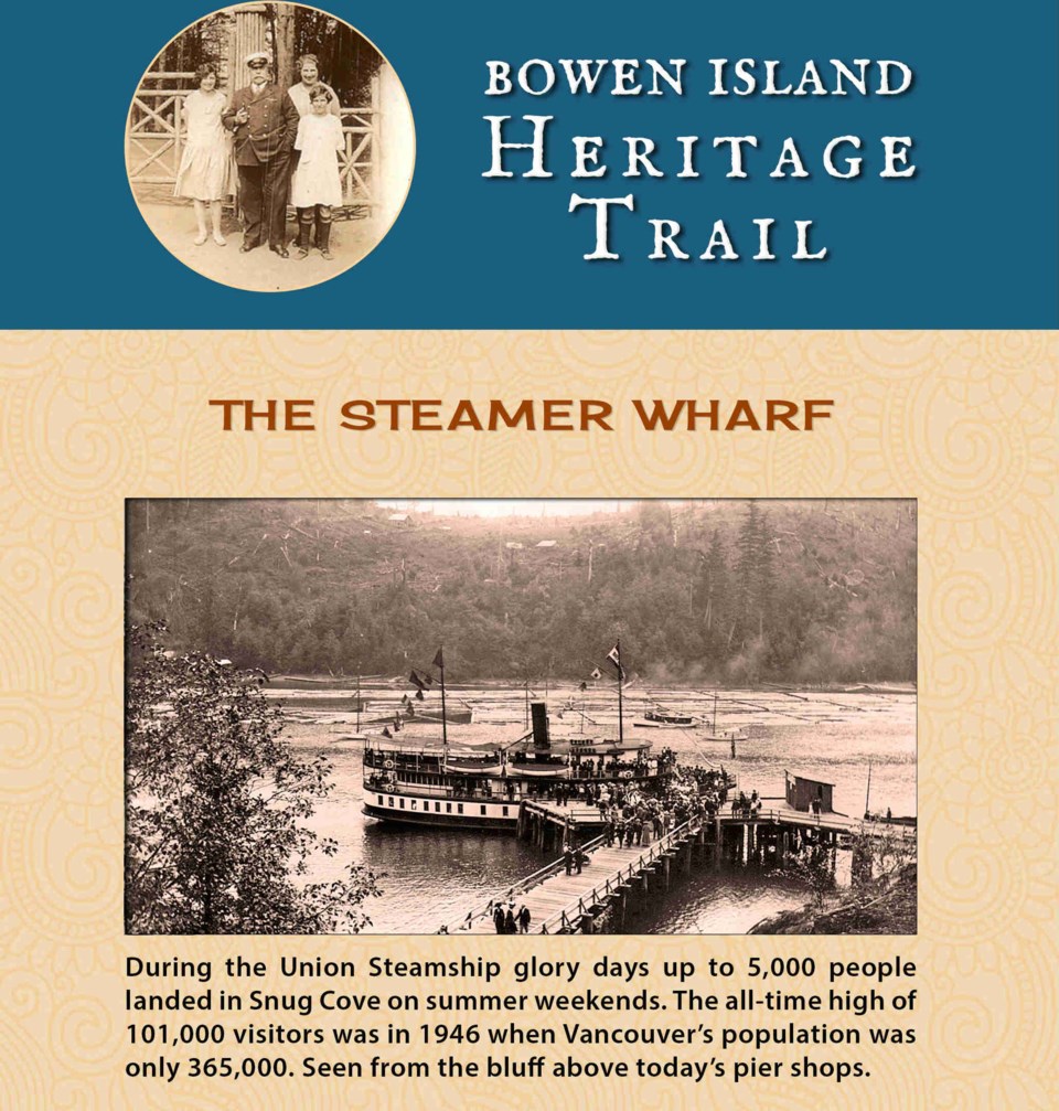
If you’ve ever wandered by the causeway and wondered what the area looked like 90 years ago, you’re in for a treat.
Local web designer John Dowler has mapped a heritage trail, to be marked by discrete signs around Snug Cove. The signs feature a cou- ple photographs, a little writeup and a QR code (that funny black and white box with dots), but the major- ity of the information is online. The signs entice you to pull out your phone, use the QR code (or plunk in the url) and peruse history.
“Bowen Island for thousands of years was visited by First Nations, and it remains part of their tradi- tional territory. These pages give a taste of the most recent century,” reads the website.
Dowler started the Bowen Trails site, which maps out the Island’s trails more broadly, a few years ago, getting data from BIM and the Rotary Club.
“I have a very longstanding interest in keeping trees up,” said Dowler. “If people knew more about where the trails are and felt safe going on them, we’d spread out the people who are using the trails, making a nicer experience and also people kind of become stewards of the forest.”
The website is at https://bowen- trails.ca/heritage/.


