Historically, one of the challenges of hiking up Mt. Gardner has been to figure out exactly where the trail is. School groups, tourists, locals, have all lost their way amidst the cedars and pines and branching trails at one point or another.
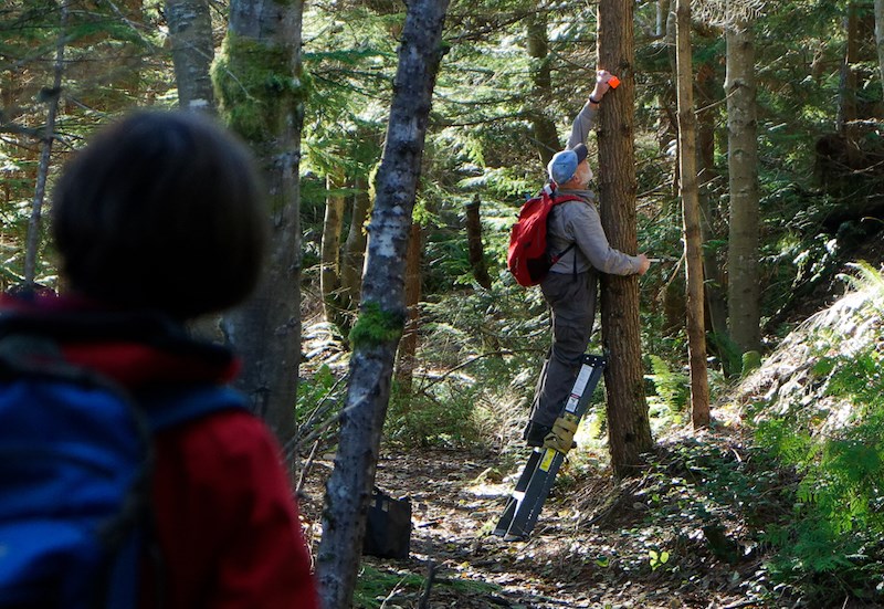
But the trek up Bowen’s tallest peak just got a little bit easier. Armed with coffee, hammers, mallets and some brand new industrial reflective red markers, a brigade of more than 20 volunteers spent last Saturday methodically marking the Mt. Gardner Skid Trail.
The Bowen Island Trail Society (BITS) organized the work party, which involved just as much pulling down old unofficial markers, left by various community members over the years, as putting up new ones.
“There’s sort of a cocktail of different trail markers,” said the project’s volunteer coordinator, Bob Schutlz. Schultz says that they found markers ranging from painted tin can lids, orange blazes to flagging tape. They also found action figures, plastic chickens and a porcelain wizard.
“There’s less noise on trail now,” said Schultz.
The society is part of a Bowen trails coalition formed last May. In partnership with the Crown (which owns 40 per cent of the land on Bowen, including much of Mt. Gardner), Bowen Trail Riders Association and Bowen Island Horse Owners and Riders Association, BITS is trying to improve signage and navigation on Bowen trails.
As BITS is working with the province, all markers and signage need to have B.C. Parks approval, otherwise Schultz jokingly added, action figures would have pointed the way to the top.
Schultz says that the new reflective markers should make the trail discernible, even in bad weather or darkness.
This Mt. Gardner project is a trial run and BITS is looking for community input about how useful hikers find the new markers. For that email [email protected], or message the society on Facebook.
Phase two of the project would be proper and consistent signage on the trails.
The society has got a couple of prototypes in the works, but Schutlz says that the organization is aware that this could be a sensitive point on Bowen.
“What everybody loves about these trails is that they’re really raw,” he says. “You can feel like maybe you’re the first one to walk there in a while.
“The last thing we want to do is overdevelop the trails,” he says.


