Our beaches are an important part of Bowen’s natural capital. They are valuable habitat for wildlife and support the integrity of our island’s natural assets. Beaches are important recreational hubs, contributing to neighbourhood pride and providing places for people to gather and interact with each other and their natural surroundings – including the annual polar bear swim at Bowen Bay beach.
Bowen’s beaches range from broad, sandy beaches that are frequently visited, to tiny pocket beaches nestled on steep rocky coasts that currently almost disappear at high tide. We can expect our beaches to exhibit a variable response to rising sea levels.
Sea level around Bowen Island has risen measurably in the past half century and we can expect it to continue to rise over the coming decades and centuries because of warming and melting glaciers and ice sheets. Sea level rise in the 21st century may exceed one metre around Bowen.
Rising sea level means we can also expect extreme high-water levels during storms and king tides.
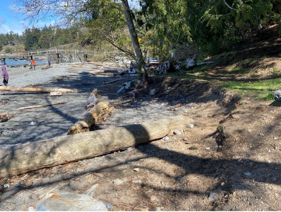
A recent visit to the beach at Tunstall Bay reveals some evidence of the rising waters and related effects. An erosion scarp has developed at the edge of the grassy terrace near ocean side of the public access trail.
Although scarp erosion is evident in this backshore area, the beach foreshore has a healthy mix of sand, gravel and cobble-sized sediment; a feature that provides important habitat for forage fish spawning.
As waves enter Tunstall Bay from offshore, they expend most of their energy on the intervening rocky headlands while spreading their energy along the shoreline in a process known as wave refraction.
As sea level rises, the pocket beaches will migrate landward and upslope due to wave and tide processes, provided there is space in the backshore area to accommodate this migration and the sediment supply to the beach is not drastically altered by either shoreline armouring or upland development.
Much of the supply to Tunstall Bay’s municipal beach comes from Explosive Creek and from erosion of the backshore scarp and bluff behind the beach. Allowing the stream and backshore to respond naturally to waves, tides and highwater levels is perhaps the best adaptive approach to adopt to maintain the natural character of Tunstall Bay Beach.
Excessive backshore development and engineered shore protection combined with rising sea levels lead to “coastal squeeze” whereby the natural functioning of shoreline processes may be diminished or halted. This leads to gradual and permanent loss of sediment and disappearance of beaches.
Phil Osborne is a PhD, Professional Geoscientist, Coastal Geomorphologist and member of the BIM Parks, Trails, and Greenways Advisory Committee


